The construction sector has adopted cutting-edge technologies to boost efficiency, safety, and project management. One of the most valuable innovations is obtaining an aerial view of a construction site. Aerial photographs offer a full picture that can only be seen from the air, whether taken by drone, helicopter or satellite.
In today's world contractors, architects, engineers, and project managers use aerial photography to keep track of the project, look for potential problems and provide updates to clients. For larger and more complex construction projects, it has become commonplace to have an aerial view for successful project management.
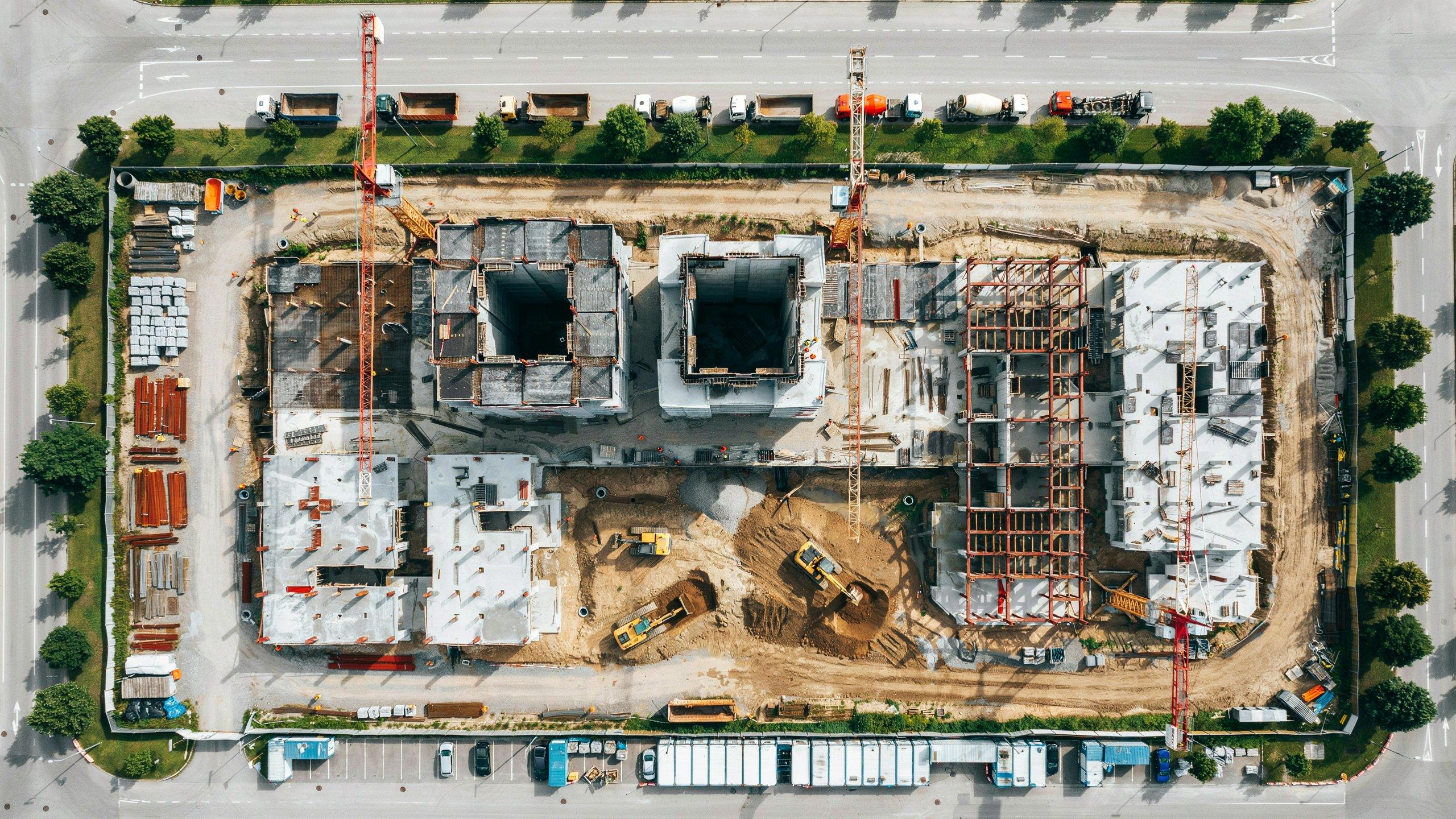
What Is an Aerial View of a Construction Site?
An
aerial view of a construction site is photographs or videos taken from above using a drone, aircraft or satellite technology. These images provide a bird's-eye perspective of the entire project, making it easier to monitor construction activities and evaluate site conditions.
Aerial imagery enables teams to view the entire project without having to walk the entire site, unlike traditional inspections.
Benefits of an Aerial View of a Construction Site
1. Better Project Monitoring
Construction managers can compare weekly or monthly aerial images to measure progress accurately. This helps ensure that the project stays on schedule and allows managers to identify delays before they become major problems.
2. Improved Safety
Safety is a top priority on every construction project. An aerial view of a construction site helps identify unsafe working conditions, equipment placement issues, blocked access routes, and hazardous zones without putting inspectors at risk.
Regular aerial inspections contribute to safer working environments and improved compliance with safety regulations.
3. Accurate Site Planning
Before construction begins, aerial surveys provide valuable information about:
- Existing structures
- Land elevation
- Drainage patterns
- Road access
- Utility locations
- Environmental conditions
These insights help engineers create better construction plans while reducing unexpected challenges.
4. Easier Communication
Clients often struggle to understand technical construction reports. Aerial photos and videos provide clear, easy-to-understand visual updates.
Project managers can use drone footage during meetings to demonstrate completed work, upcoming phases, and overall project status.
How Drones Have Changed Construction
Drones have revolutionized construction management because they are affordable, efficient, and capable of capturing high-resolution images within minutes.
Modern construction drones can:
- Capture 4K videos
- Create 3D site models
- Perform topographic surveys
- Generate orthomosaic maps
- Measure stockpile volumes
- Conduct thermal inspections
These capabilities make drone technology one of the most valuable tools in today's construction industry.
Common Uses of Aerial Construction Photography
Progress Documentation
Construction companies document every phase of a project using aerial photography. These images serve as records for future reference, quality assurance, and client reporting.
Marketing Projects
Developers frequently use drone footage to showcase ongoing and completed projects on websites, social media platforms, and promotional videos.
High-quality aerial visuals attract investors and demonstrate professionalism.
Site Inspections
Inspectors can review roofing work, structural components, excavation areas, and large infrastructure projects without requiring expensive scaffolding or cranes.
Quantity Verification
Drone software can calculate material quantities such as soil, gravel, or concrete stockpiles with impressive accuracy.
This helps contractors manage inventory more efficiently.
Technologies Used for Aerial Construction Monitoring
Several technologies contribute to capturing an accurate aerial view of a construction site, including:
- Drone photography
- LiDAR scanning
- GPS mapping
- Geographic Information Systems (GIS)
- Photogrammetry
- Satellite imagery
- Artificial Intelligence (AI) image analysis
Together, these technologies help construction teams make faster and more informed decisions.
Industries That Benefit from Aerial Construction Views
Many sectors use aerial construction monitoring, including:
- Residential construction
- Commercial developments
- Highway construction
- Railway projects
- Airports
- Bridges
- Industrial facilities
- Solar farms
- Wind energy projects
- Mining operations
Regardless of project size, aerial monitoring improves visibility and project coordination.
Challenges of Using Aerial Technology
Although aerial monitoring offers many advantages, there are some limitations.
Weather Conditions
Rain, fog, and strong winds may prevent drone flights and reduce image quality.
Regulatory Requirements
Drone operators must comply with aviation regulations and obtain necessary permissions before flying in restricted areas.
Data Management
Large construction projects generate thousands of images and videos that require secure storage and organized management systems.
Initial Investment
Professional drones, software, and pilot training require upfront investment. However, many companies recover these costs through improved efficiency and reduced project delays.
Best Practices for Aerial Site Monitoring
To maximize the benefits of aerial construction photography, companies should:
- Schedule regular drone flights.
- Capture images from consistent angles.
- Store images in organized project folders.
- Compare progress over time.
- Integrate drone data with project management software.
- Follow all local aviation regulations.
- Use certified drone operators whenever required.
Following these practices ensures reliable documentation and accurate reporting throughout the construction lifecycle.
The Future of Aerial Construction Technology
Construction monitoring is still in its early stages, and as new technologies emerge in the field of automation and AI, it will continue to change. Scheduling is possible without manual control of drones to inspect sites and the AI-based software can identify defects in construction, track equipment use and anticipate project delays.
Moreover, virtual copies, or digital twins of construction sites are increasingly being used. When paired with 3D modeling, visualizing the progress of a project with drone images allows construction teams to make informed decisions more effectively.
Conclusion
The way construction professionals plan, monitor and manage construction projects has changed with an aerial view of construction. Aerial technology offers insights that are invaluable compared with traditional inspections, from helping to improve safety and track progress to facilitating communication and cost savings.
With the ongoing evolution of drone technology, AI capabilities, and digital mapping, the role of aerial monitoring in the construction industry is set to become even more critical in the future.As technology continues to evolve, such as drones, AI capabilities, and digital mapping, aerial monitoring will continue to play a vital role in the construction industry, especially for companies looking to complete projects efficiently, safely, and with greater accuracy. By using these technologies today, businesses can better equip themselves to handle the requirements of modern construction projects.